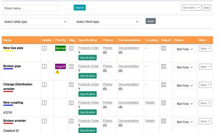
Infrastructure works list
- Works Names:
The table lists the names or titles of various utility works currently in progress.
- Popup Map with Location:
Integrated within the table is a dynamic map feature that allows users to pinpoint the exact location of each utility work.
- Products Specification Link:
This feature provides a direct link to the specifications of products associated with each utility work. It allows quick access to detailed information about utilities and acessories required for the work.
- Photos Link:
A dedicated link to access visual documentation in the form of photos related to the utility work. Users can review images depicting the work site, progress, or specific aspects of the construction.
- Documentation Link:
This link enables easy access to relevant documentation or files associated with the utility work. It may include permits, technical documents, or other essential paperwork necessary for the project.
- Utility Locating Details popup window:
This popup window enables easy access to relevant documentation or files associated with the utility work. It may include permits, technical documents, or other essential paperwork necessary for the project.
- Edit and Delete Buttons:
These interactive buttons empower users with the ability to modify or delete information related to specific utility works directly from the table interface. This functionality allows for quick adjustments or removal of outdated or inaccurate data.

